
Stillwater Postal Roles
Five ZIP codes serve postal functions associated with Stillwater. Two handle ordinary street delivery, one is a post-office-box designation, and two belong to Oklahoma State University mail operations. A ZIP code is a routing field, not a municipal boundary, ownership record, or list of people at an address. For a physical address, use the full address check first and then match the result to the land and map records that describe the particular parcel.
| ZIP | Areas Covered | Post Office | Notes |
|---|---|---|---|
| 74074 | Standard Stillwater street delivery | Stillwater Post Office | USPS lists the Stillwater Post Office at 809 S. Lewis St.; verify the complete address before relying on the ZIP. |
| 74075 | Standard Stillwater street delivery | Stillwater postal delivery | Postal geography may differ from an assumed municipal line. |
| 74076 | Stillwater post-office boxes | Stillwater postal delivery | A box ZIP does not establish the boxholder's physical location. |
| 74077 | OSU Residential Life and on-campus residences | OSU University Mailing Services | Institutional residential route, not a general neighborhood ZIP. |
| 74078 | OSU departmental and administrative mail | OSU University Mailing Services | Institutional route, not a general household ZIP. |
These postal roles prevent a false equivalence. A 74076 mailing label points to a postal box, while 74077 and 74078 point to distinct university delivery contexts. A match in a standard ZIP is also only a postal result. It should be followed by an address-level property or map check when the question involves a particular place.
Note: Postal labels help route mail, but they do not establish City jurisdiction, parcel ownership, or current residence.
Stillwater Campus Mail Routes
Oklahoma State University makes the campus distinction unusually clear. Its student-mail FAQ says 74077 is for a single Residential Life or on-campus residence, and University Mailing Services delivers campus mail in both 74077 and 74078. The University's mailing-services policy confirms those two campus ZIPs. Neither is evidence that a person is a current campus resident.
This is a records-geography issue as much as a postal one. A campus address may need the precise campus delivery format, while a nearby street address could use a regular Stillwater route. Treat a university ZIP as a delivery instruction. For historical research, a dated directory, yearbook, or archive record can show an earlier affiliation, but it does not replace an address verification for the present.
Verify a Stillwater Postal Route
The USPS postal lookup is the official check for a postal assignment. Enter the full street address with city and state when possible. A ZIP-to-city search can be useful as a rough label check, but the full address check is the stronger result because it tests the actual delivery address rather than a broad geographic name.
The USPS lookup screen below is the starting point for that check. Save the address exactly as returned before comparing it with a parcel card, a legal description, or a City map. Small changes in direction, suffix, unit, or campus format can matter.
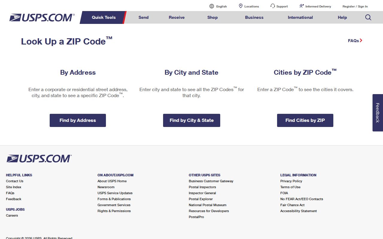
USPS verifies mail routing, not city limits. When the result matters for a Stillwater parcel question, the next check is the City's boundary and parcel context rather than a ZIP label alone.
Search Within a Stillwater ZIP
No official source reviewed for Stillwater verifies a public ZIP-wide property or voter search. The Payne County Assessor's basic public query modes are account, address, and owner. The OK Voter Portal requires a registrant's last name, first name, and date of birth, so it is not a public browse-by-ZIP tool. A postal code therefore works best as an address-checking and geography step, not as a shortcut to a roster.
- Use USPS to confirm the full address and its postal ZIP. Record the street number, directional prefix or suffix, unit, and the returned mailing format.
- Open the City of Stillwater's All Layers map to compare the street and parcel with the City boundary. The map has parcel, street-centerline, zoning, boundary, and other context layers.
- Search the confirmed address in the Assessor's property record card. Use the location and legal-description fields to anchor the land record, not the ZIP as a claim of ownership or residence.
- When the question narrows to one street, use the Stillwater street directory route for the address-by-address record sequence.
For voter-service questions, the OK Voter Portal is for an individual record with the required name and date of birth. The State's broader voter-file route has qualification and privacy restrictions. It should not be described as an open ZIP browser.
Stillwater ZIP Search Limits
The Payne County Property Record Card, linked by the Assessor, is useful after a ZIP check has yielded a precise address. Its captured public controls support property research by account, address, or owner. The advanced configuration includes land-use, improved or vacant, fire-district, neighborhood, section, township, and range filters. It does not verify a public ZIP filter, so a ZIP-wide result must not be promised.
| Field or mode | Use after a ZIP check |
|---|---|
| Account | Search a known property account when one is available. |
| Address | Search the USPS-confirmed street address; this is the primary route for a parcel question. |
| Owner | Find an assessed owner record, which is not a household roster. |
| Map and advanced search | Use property geography and the available filters, then verify the resulting parcel details. |
The record-card configuration distinguishes a formatted location from billing address, city, state, and ZIP. Those fields can disagree without creating an error. A mailing address is for correspondence, while the parcel location is the situs address used to locate the land.
The Assessor's main site also links Land Records, printable maps, GIS access, and the property card. If the online card leaves a field unclear, the Assessor offers an office and email fallback for property questions. Its current form-submission notice directs users to email or an office visit rather than an online form. That is a better next step than inferring a ZIP-wide result from a map label.
Stillwater ZIP Boundaries
Postal coverage and legal city geography answer different questions. A Census ZCTA is a statistical approximation, not a USPS delivery boundary. Likewise, a Stillwater postal label does not by itself show whether the address lies inside the municipal boundary. The City of Stillwater Maps page provides the All Layers map and its city-boundary, parcel, and street-centerline context for that comparison.
The City calls its GIS material advisory and subject to revision. It is useful for a practical boundary check, but it is not a survey, title, appraisal, engineering, or zoning determination. Use the parcel's recorded legal description and the proper custodian when an exact boundary or title question remains.
The Stillwater Maps page visibly provides the City’s All Layers entry for comparing a postal result with local parcel geography.
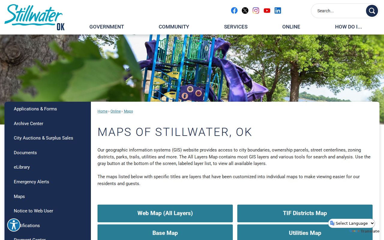
The map is useful for a ZIP-boundary question after USPS validates the address, but the City’s advisory notice means it cannot replace a recorded land description.
Boundary check. A ZIP may cross or differ from a municipal line. Confirm the full postal address with USPS, then inspect the specific parcel in the City map and County land records.
Stillwater ZIP Address Terms
Several address fields can appear on the same record and still mean different things. Keeping them separate prevents a postal match from being treated as a deed description or a tax mailing fact from being treated as a parcel location.
- Situs address
- The physical location used to identify the assessed parcel.
- Mailing address
- The correspondence address shown on a tax or property record. It can be different from the situs address.
- Legal description
- The lot, block, subdivision, or section-township-range description used in recorded land instruments and plats.
- ZIP code
- A postal-routing field that helps deliver mail. It does not define the City boundary or the parcel.
- ZIP+4
- An added postal routing detail attached to a five-digit ZIP for a more specific delivery segment.
- Carrier route
- A postal delivery grouping used for mail routing, not a government boundary or resident list.
Stillwater ZIP Geography Clues
ZIP research becomes more reliable when it is paired with the local street pattern. In College Gardens, the City conservation material describes a 1927 plat and 1930s replatting, curvilinear roads, parks and boulevards, decorative tile curb names, and WPA sidewalks. A simple rectangular-grid assumption can mislead an address search there. The parcel's subdivision, lot, block, and map location are better bridges between a postal address and an older record.
Stillwater also grew around the county seat and Oklahoma A&M, later OSU. That history helps explain why institutional mail, campus records, and ordinary postal delivery can meet within a small area without using the same route. A postal code is useful orientation, but the address, parcel, and dated source remain the stronger research anchors.
Note: No official source reviewed here identifies a citywide ZIP realignment date or a historic street-renumbering event.
Stillwater ZIP Record Limits
A postal ZIP does not unlock protected or nonpublic records. Oklahoma voter protections exclude Address Confidentiality Program participants and other protected records from public voter data. The public individual voter tool is intentionally narrow, and phone or email fields are not voter-registration data. Public land records can also be incomplete, dated, or connected to a mailing address rather than the parcel itself.
Use postal and land information for lawful personal research, family history, estate questions, or civic curiosity. Do not use a postal code, map, or record trail to stalk, harass, threaten, or harm anyone. When an official record is needed, verify it with the office that maintains it.